Locations
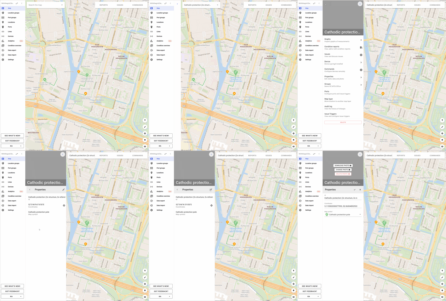
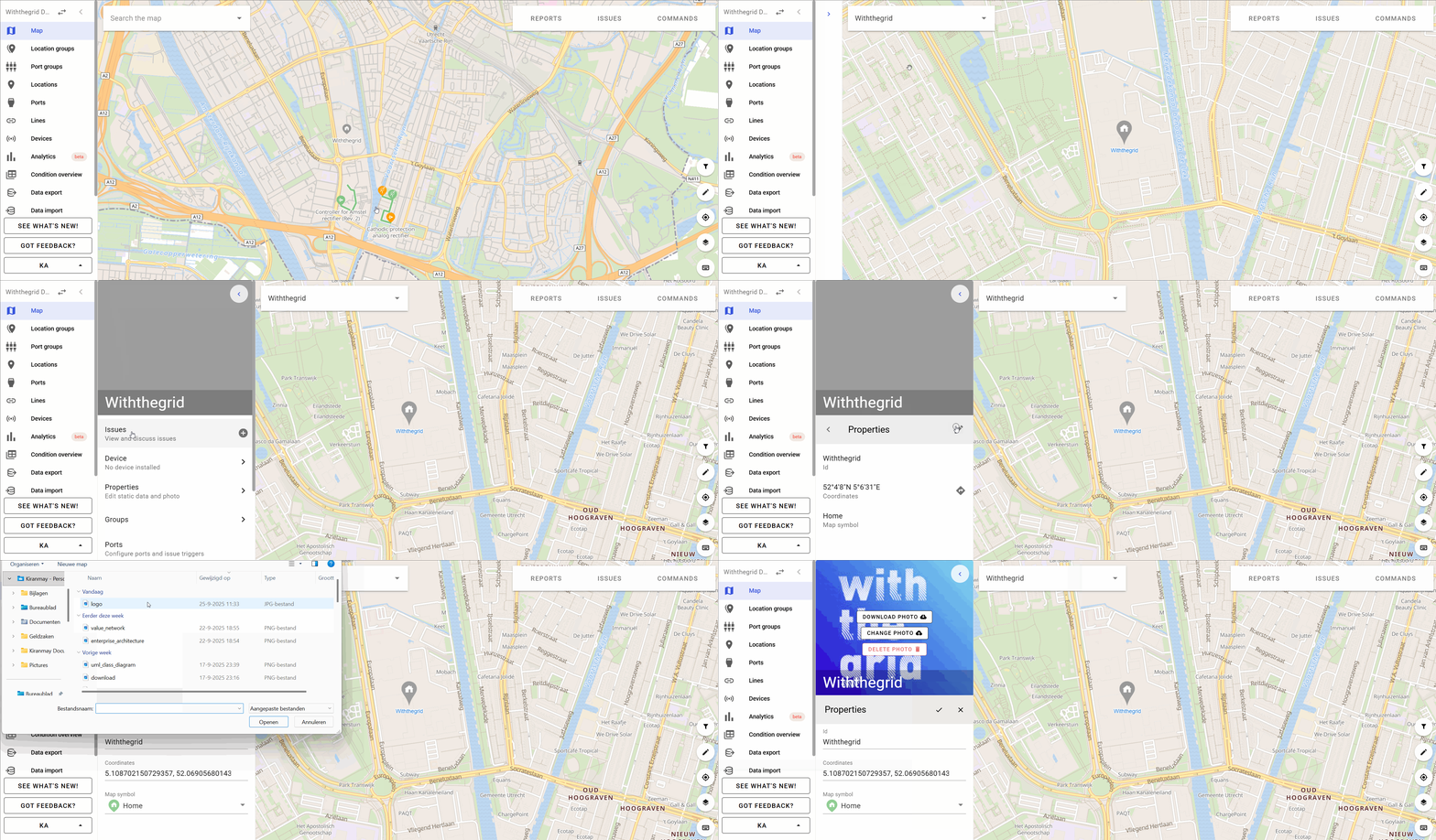
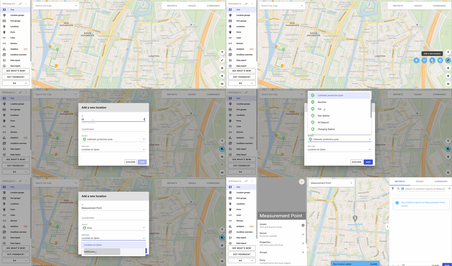
Locations form the core of the asset monitoring platform. On each location measurements are recorded. Locations can be added by clicking on the add location icon on the bottom right of the map.
This can be done either by manually selecting a spot on the map, or by submitting GPS coordinates.
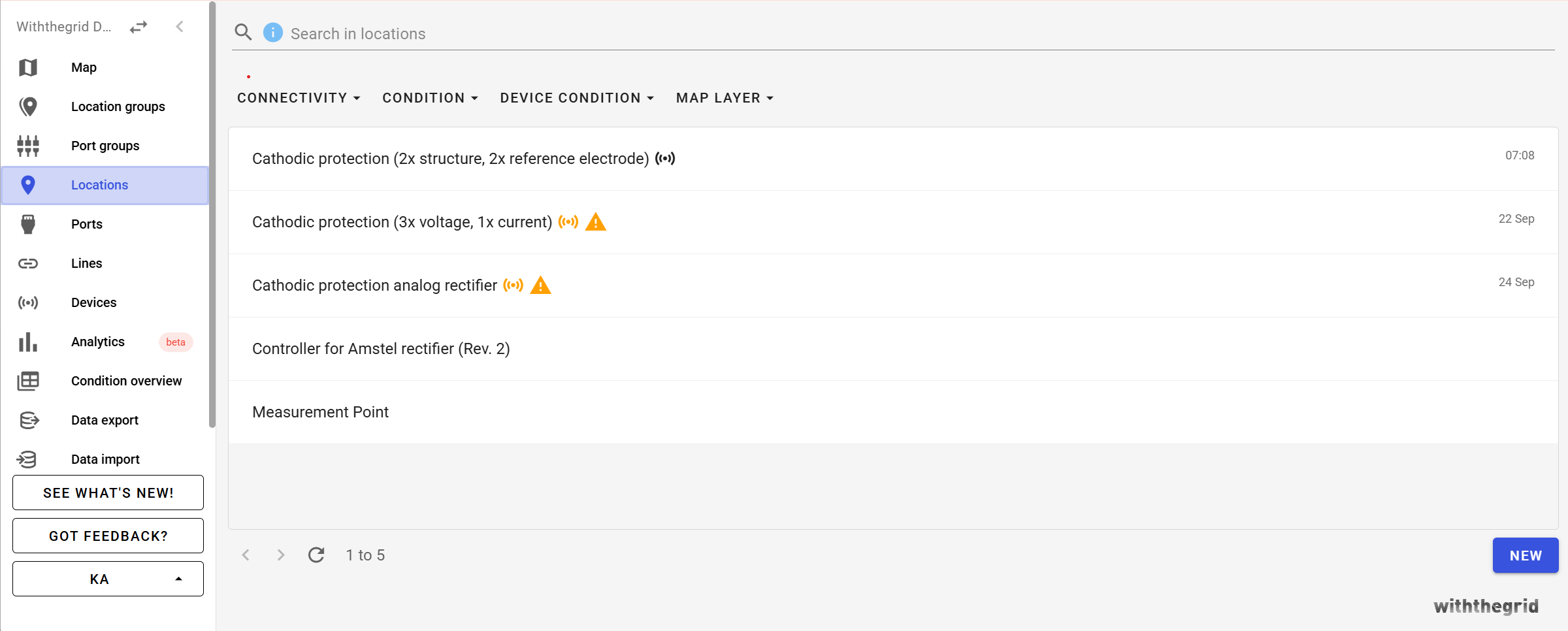
On the left hand side the location view is opened where all locations are shown including a search function.
The list of and the link to all created locations can be accessed by selecting the locations icon on the left hand side menu bar.
Location-ports
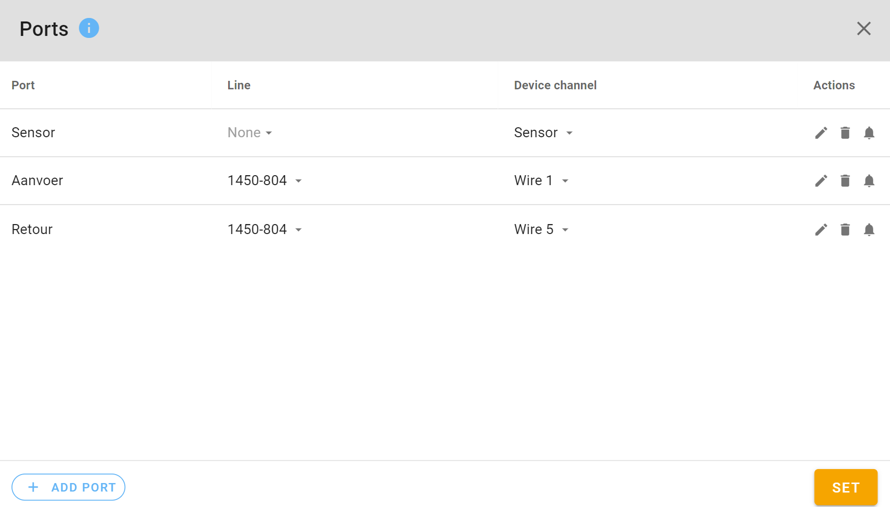
Each location can consist of multiple location-ports. These are ports onto which measurements are made. For example: a substation can be a location and the ports can be: Transformer, low voltage rack, medium voltage rack etc. An unlimited number of ports can be added to a location. In case there are lines in the vicinity of a location then each port can also be coupled to a line or line segment.
Searchable ports
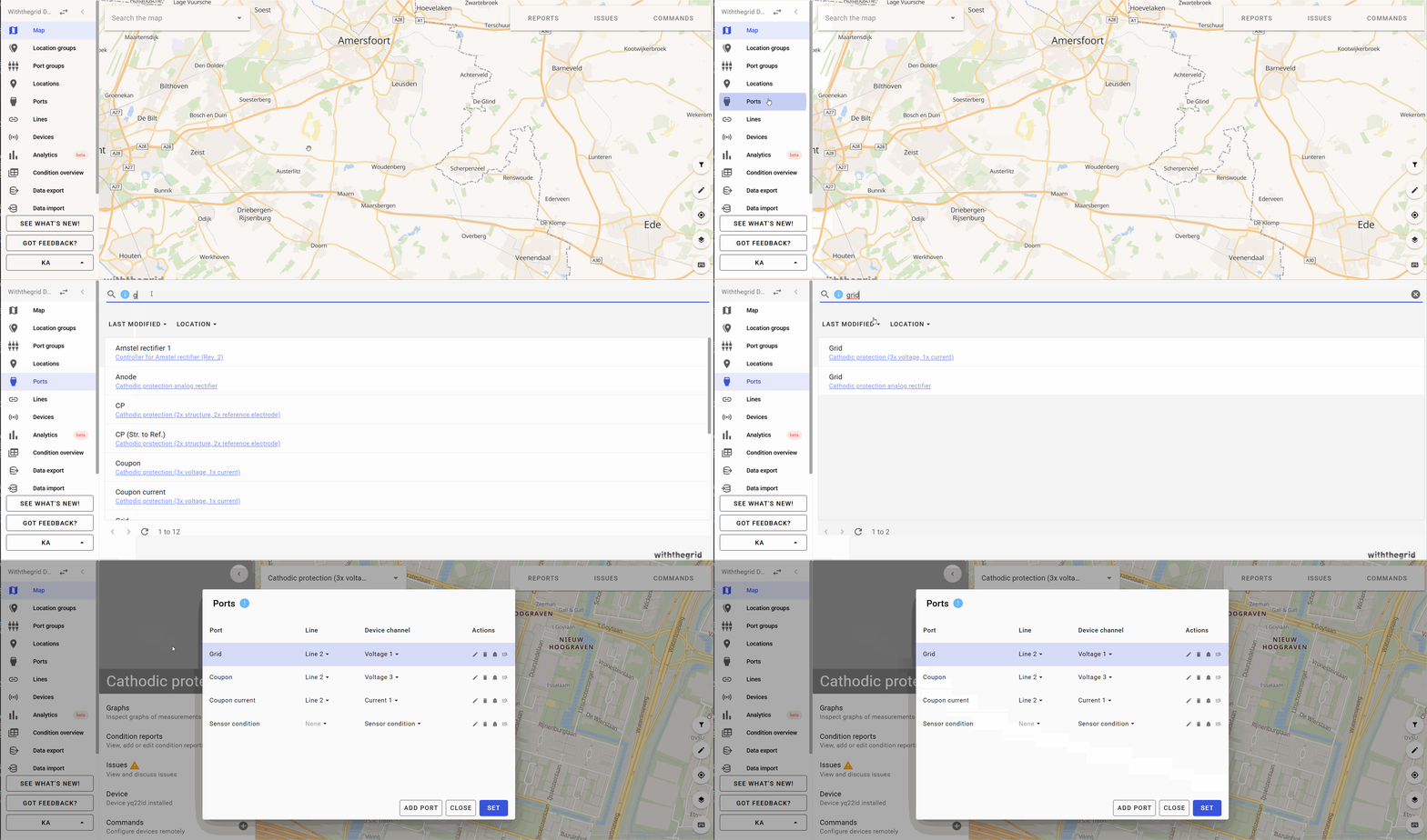
Ports, often containing measuring points, are searchable. This allows for gaining faster insights with regards to specific ports.
Configuring locations
It is possible to add static properties to locations. For example: pipe diameter, manufacturer, color, warranty date etc. These fields are called form fields and are configured in the environment settings (see form fields in environment settings). If there is an API with a GIS system then the data is automatically loaded.
